
PANORAMIC MAP

Production and Manufacture of Panoramic Maps

Many similar terms are also used for the panoramic map, such as panorama, relief panorama, panorama map, bird's-eye view map, 3D map, 3-dimensional map, three-dimensional map, plastic map, plastic panorama, panoramic image, photorealistic maps. In English they are called panoramic map, trail map or ski map.

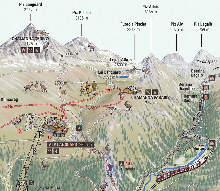
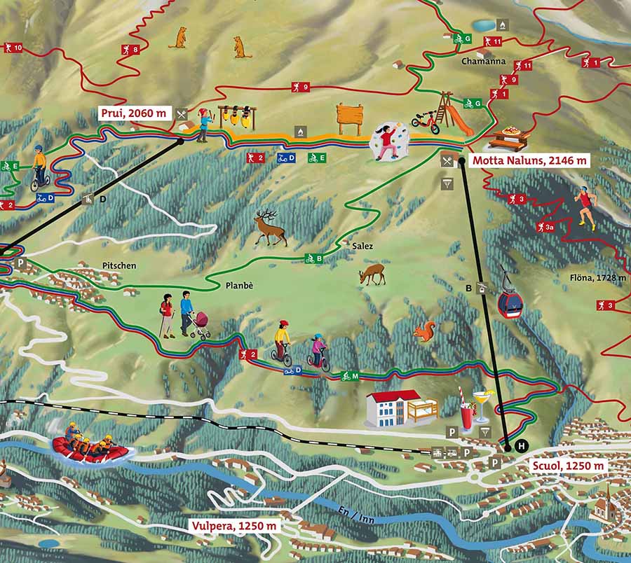
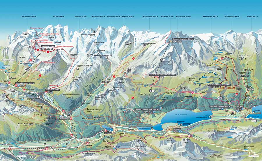
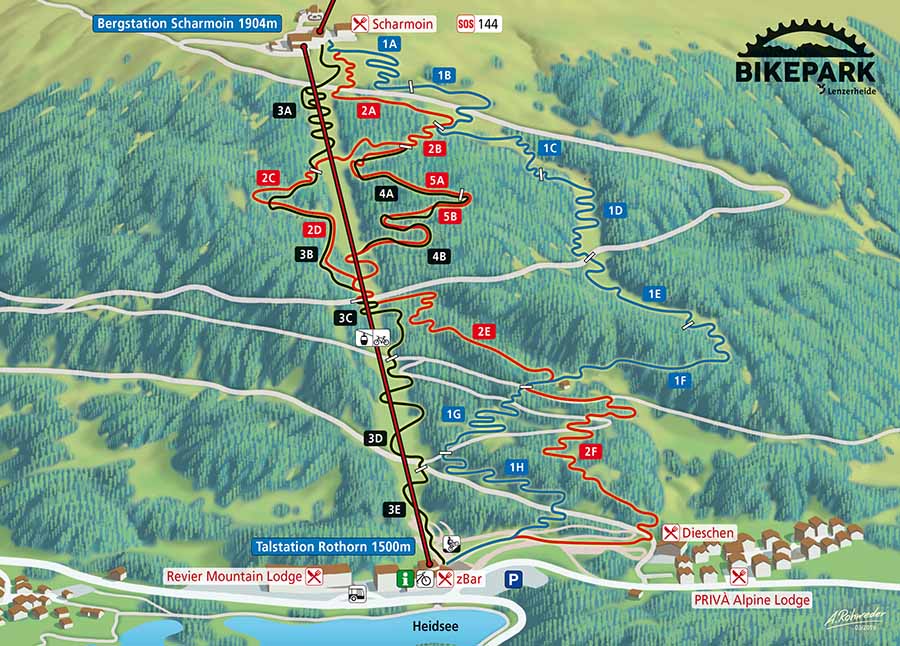
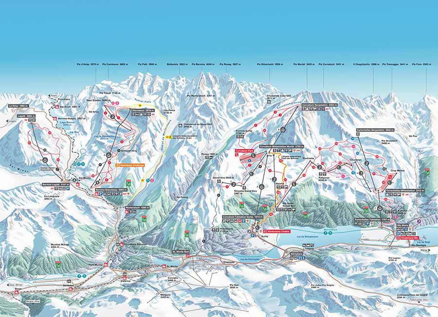
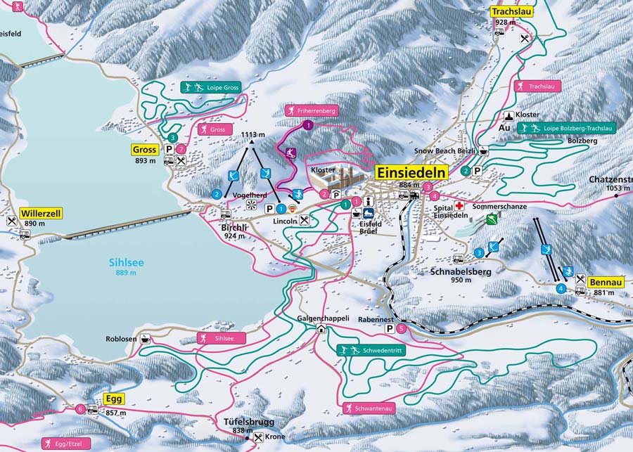
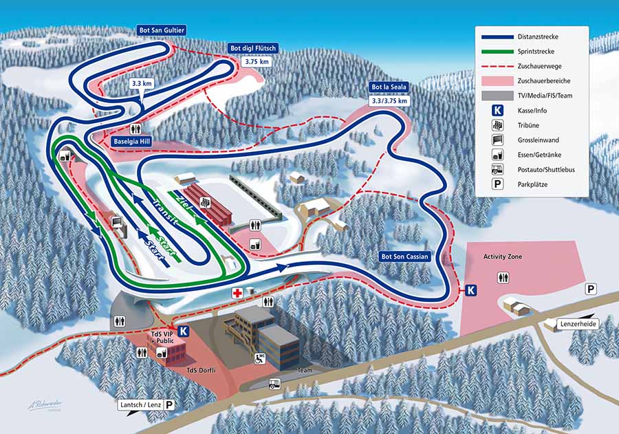
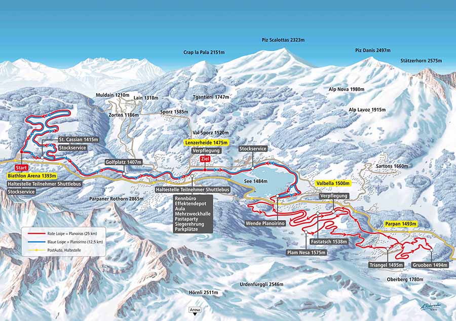
A panoramic map is a pictorial map that illustrates geographic conditions by covering a large viewing angle as seen from the air (or from a "bird's eye view"). The special effect unfolds through the plastic representation of the landscape.

We change the landscape or the cityscape in the panorama map in such a way that the viewer has an optimal view of an area, can look into a valley that would remain hidden to him or reduce a city to the essential sights without the tourist noticing or at least not being bothered by it. Because all that matters to him is that he gets the information he is looking for and needs for a specific purpose.

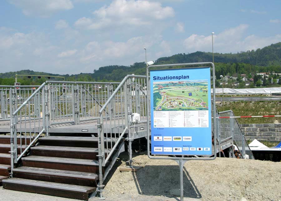
A panoramic map provides initial information about an area. So it is not about the absolute reality-faithful cartographic image in a certain scale, but about the creation of an idealised image, which is supplemented with information in terms of content. This can be a skiing area, a hiking region, a town or even a fairground. The viewer gets a quick overview of the special features of the area, which the panorama painter emphasises.

3D Panoramic Map as Digital Elevation Model DEM

We can optimize 3D computer models according to customer requirements.

For more information on customized
3D ski and hiking trail maps
please contact us:

ILLUSTRATED MAPS FOR YOUR TOURIST AREA

ILLUSTRATED MAPS

Where is the show dairy and how do I get to the suspension bridge? Where can I go windsurfing, fishing or stand-up paddling? Our illustrated adventure maps provide a quick overview of leisure activities in your tourist region.

TOURIST MAPS

Our cheerful illustrations arouse emotions and the spirit of discovery! All illustrations are self-explaning and easy to understand even for children.

FOR YOUR HIKING AND MOUNTAIN BIKE DESTINATION

OUTDOOR ACTIVITY MAPS

Every tourism destination is unique - just like maps created by Arne Rohweder. Customized panoramic maps offer quick overview of a tourist area with many tips for leisure activities. Illustrated maps are very suitable for print products such as brochures, flyers and large information panels. Panorama and trail maps can also be easily integrated into a mobile app, used on smartphone or for interactive online maps.

MOUNTAIN BIKE MAPS

Demanding MTB tour or better a leisurely bike ride? Rohweder mountain bike maps are clear and easy to read, showing the most beautiful mountain bike routes and trails in the region. Must-have for every mountain bike destination.

WINTER SPORTS MAPS FOR YOUR SKI RESORT

SKI MAPS / PISTE MAPS

Every skier knows it - the ski map. It is the first point of contact between a tourist destination and the guest. The so-called "first touch" often happens through various online and booking platforms. Rohweder ski map offers a quick and informative overview of your ski resort.

SNOW SPORTS MAPS

A perfect overview map of all winter sports activities in your ski area. Rohweder snow sports maps show detailed information on recommended winter hiking trails, snowshoe trails, ski slopes, ski tours, wildlife refuge, toboggan runs, cross-country skiing trails, mountain railways and cable cars, ice rinks and much more. We keep the map up-to-date and adapt the content to the current situation of leisure activities in your destination.

CROSS-COUNTRY SKIING AND NORDIC TRAIL MAPS

STADIUM MAPS / BIATHLON MAPS

All important information about your cross-country skiing center and biathlon arena at a glance! A detailed stadium plan is essential for important events such as the Biathlon World Cup or the Biathlon World Championship. We would be happy to design a new modern stadium map for your cross-country ski resort.

CROSS-COUNTRY SKIING / NORDIC SPORTS

Classic or skate technique? Demanding ascent or easy descent? Where are the cloakrooms and toilets? Thanks to a detailed cross-country skiing trail map, your guests have a perfect overview of the entire trail network in your cross-country skiing region.